
Risk overview
Seven-day weather risk overview
Daily weather risk summary
|
|
|
|
|
|
|
|
|
|---|---|---|---|---|---|---|---|
| risk level |
|
|
|
|
|
|
|
No risk
Low risk
High risk
What factors are driving the risk?
The graphic shows the weather factors that have some risk for the next 7 days. Click on the colored boxes to see what the risk factors is based on and what impact it may have.
| Wind Risk |
|
Wind Risk: risk level 0
|
Wind Risk: risk level 0
|
Wind Risk: risk level 0
|
Wind Risk: risk level 0
|
Wind Risk: risk level 0
|
Wind Risk: risk level 0
|
|---|
No impact in 11 other categories: Severe Thunderstorm Risk, Tornado Risk, Thunderstorm Wind Risk, Hail Risk, Lightning Risk, Excessive Rainfall Risk, Frost/Freeze Risk, Fog Risk, Fire Weather Risk, Coastal Flood Risk, Marine Hazard Risk
Sunday: Wind Risk
1: Limited
Breezy conditions could blow around unsecured items and result in hazardous driving conditions for high-profile vehicles. Sustained winds 20-30 mph or gusts 30-45 mph.
What is this based on?
We base this risk on local weather office wind speed/gust forecasts.
Risk map
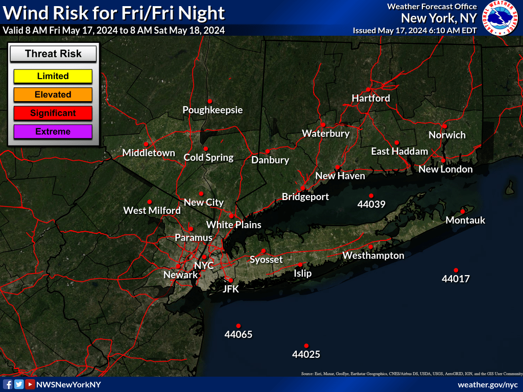
Risk levels
| risk level name | risk level description |
|---|---|
|
1:Limited
|
Breezy conditions could blow around unsecured items and result in hazardous driving conditions for high-profile vehicles. Sustained winds 20-30 mph or gusts 30-45 mph. |
|
2:Elevated
|
Windy conditions could damage outdoor items and result in hazardous driving conditions for high-profile vehicles. Power outages are possible. Sustained winds 31-39 mph or gusts 46-57 mph. |
|
3:Significant
|
Very windy conditions could blow down trees. Power outages likely. Sustained winds 40-49 mph or gusts 58-64 mph. |
|
4:Extreme
|
Extremely windy conditions will damage numerous trees and cause widespread power outages. Sustained winds greater than 50 mph or gusts greater than 65 mph. |
Loading the risk data...