


Risk Overview
Seven-day Weather Risk Overview
The graphic shows the daily risk summary for 7 days. Daily risk is based on highest risk factor for that day.
|
|
|
|
|
|
|
|
|
|---|---|---|---|---|---|---|---|
| risk level |
|
|
|
|
|
|
|
table legend
No risk
Low risk
High risk
Risk Factors
The graphic shows the weather factors that have some risk for the next 7 days. Click on the colored boxes to see what the risk factors is based on and what impact it may have.
| Marine Hazard Risk |
Marine Hazard Risk: risk level 0
|
|
|
|
|
|
|
|---|---|---|---|---|---|---|---|
| Lightning Risk |
Lightning Risk: risk level 0
|
|
|
Lightning Risk: risk level 0
|
Lightning Risk: risk level 0
|
Lightning Risk: risk level 0
|
Lightning Risk: risk level 0
|
| High Surf Risk |
High Surf Risk: risk level 0
|
High Surf Risk: risk level 0
|
|
|
No impact in 11 other categories: Coastal Flood Risk, WinterStorm, Tornado Risk, Severe Thunderstorm Risk, Fog Risk, Wind, Extreme Cold Risk, Excessive Rainfall Risk, Fire Weather Risk, Freezing Spray Risk, Frost/Freeze Risk
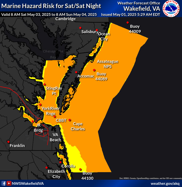
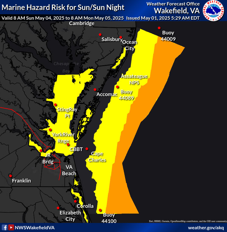
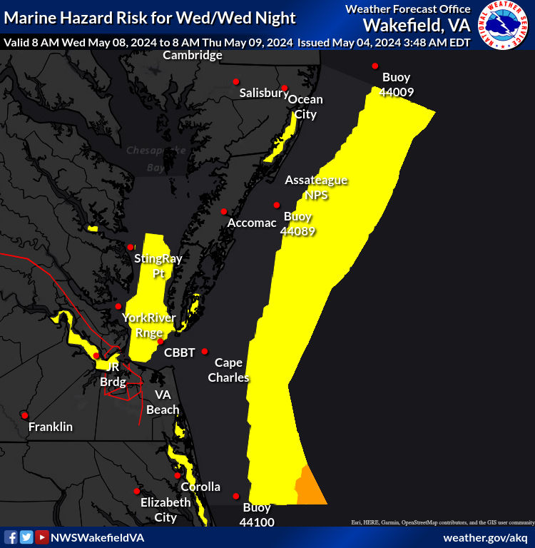
Thursday: Marine Hazard Risk
1: 1
Wind Gusts >= 20 knots (15 kt bay/rivers) and/or Waves >= 4 feet (2 ft bay/rivers).
Determining Risk
We base this risk on local weather office wind speed/gust and wave height forecasts.
Risk Map
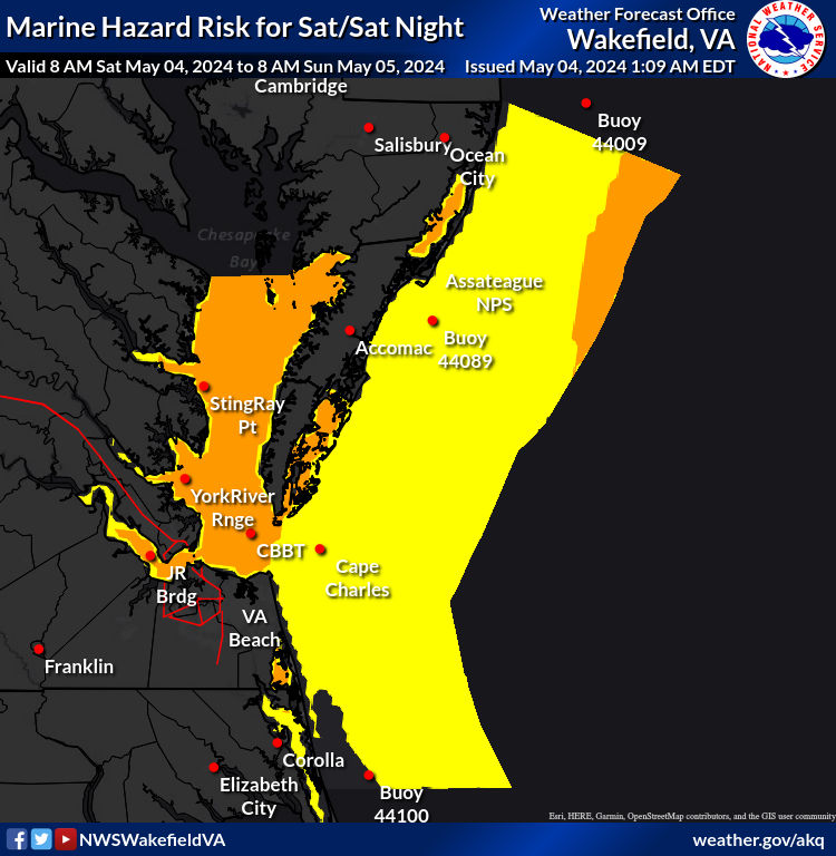
Risk Levels
| risk level name | risk level description |
|---|---|
|
1:1
|
Wind Gusts >= 20 knots (15 kt bay/rivers) and/or Waves >= 4 feet (2 ft bay/rivers). |
|
2:2
|
Wind Gusts >= 25 knots (20 kt bay/rivers) and/or Waves >= 5 feet (4 ft bay/rivers). |
|
3:3
|
Wind Gusts >= 34 knots and/or Waves >= 8 feet (5 ft bay/rivers). |
|
4:4
|
Wind Gusts >= 48 knots and/or Waves >= 12 feet (8 ft bay/rivers). |


Saved locations
Loading the risk data......